By Lesley McLaren
20th June, day two of our "Warblers" Cerdagne trip, most of us headed in different directions again. My plan was to walk Les gorges du Sègre. Even the drive there was spectacular, via the back road from our base in Saint-Pierre-dels-Forcats, through Eyne, across the meadowy tops with broom-scented air, wheatears on fence posts and Andorra mountains beyond.
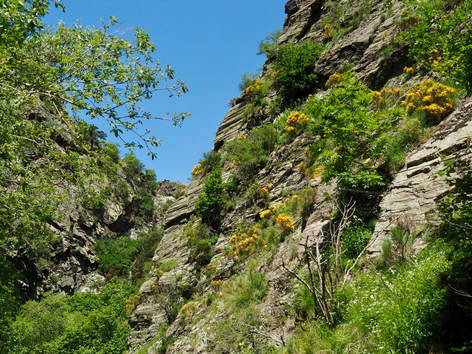
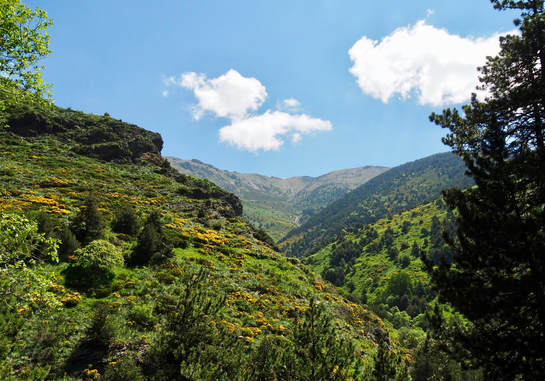
The only blot on this awe-inspiring landscape came suddenly, shortly before the road dropped into the hamlet of Llo: a huge array of industrial-sized mirrors and pipes over the grassland.* But that was soon forgotten when the dramatic crags of the Sègre Valley came into view. I couldn't wait to get going. Despite Bruce's somewhat disappointing trip (from a fauna point of view) in the neighbouring Eyne Valley the day before, I was hoping for butterflies and raptors galore, and planned to spend the day here. Me and my dog in the rugged mountains. Perfect.
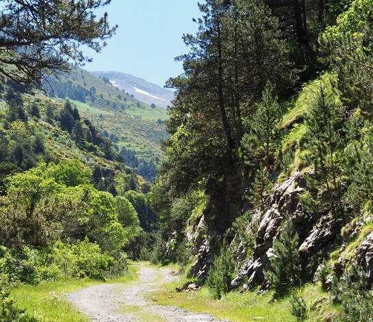
The map shows a circular walk, and friends had warned that to avoid a cardiac-arresting uphill slog, it's best to begin at the thermal baths end, just south of Llo (at about 1400m). Great advice, not least because, from the outset, this would take me alongside the loud, fast-flowing River Sègre. Where there's water there should be butterflies.
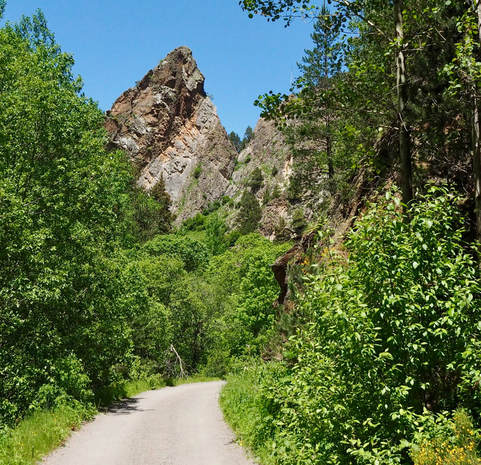
Shod in my sturdiest boots; bearing walking pole, heavy-ish rucksack (all-weather gear, first aid kit, map, water for two, sandwiches, energy snack bars aka mini Kit Kats), camera slung diagonally across my body, binos on a harness (to protect my neck) and dog on a lead (to protect everything), I was surprised to find myself on an asphalt road. In pristine condition yet prohibited to motor vehicles, it wound gently uphill through lush, mixed woodland, around and between the crags. Easy walking. Although on one hand tarmac diminishes the wildness (and can be hot underfoot in summer), on the other, it makes this place accessible for handicapped and less-than-nimble people. I was messaging Isobel immediately, to say that her electric scooter should cope with it. (It's not often she can get to the places the rest of us explore, but the next day she was to immerse herself here.)
The only blot on this awe-inspiring landscape came suddenly, shortly before the road dropped into the hamlet of Llo: a huge array of industrial-sized mirrors and pipes over the grassland.* But that was soon forgotten when the dramatic crags of the Sègre Valley came into view. I couldn't wait to get going. Despite Bruce's somewhat disappointing trip (from a fauna point of view) in the neighbouring Eyne Valley the day before, I was hoping for butterflies and raptors galore, and planned to spend the day here. Me and my dog in the rugged mountains. Perfect.
The map shows a circular walk, and friends had warned that to avoid a cardiac-arresting uphill slog, it's best to begin at the thermal baths end, just south of Llo (at about 1400m). Great advice, not least because, from the outset, this would take me alongside the loud, fast-flowing River Sègre. Where there's water there should be butterflies.
Shod in my sturdiest boots; bearing walking pole, heavy-ish rucksack (all-weather gear, first aid kit, map, water for two, sandwiches, energy snack bars aka mini Kit Kats), camera slung diagonally across my body, binos on a harness (to protect my neck) and dog on a lead (to protect everything), I was surprised to find myself on an asphalt road. In pristine condition yet prohibited to motor vehicles, it wound gently uphill through lush, mixed woodland, around and between the crags. Easy walking. Although on one hand tarmac diminishes the wildness (and can be hot underfoot in summer), on the other, it makes this place accessible for handicapped and less-than-nimble people. I was messaging Isobel immediately, to say that her electric scooter should cope with it. (It's not often she can get to the places the rest of us explore, but the next day she was to immerse herself here.)
After noting several orchids like those around our chalet, the next thing I came across was a group of young people (twenties) swishing butterfly nets and scrutinising leaves. They didn't appear to be hunting butterflies in particular. Biology students perhaps, carrying out an insect survey? Even though I was taking photos every few metres, we soon left them behind. There were one or two other walkers and some mountain bikers - even a couple of cars, which I assumed must be from a farm up ahead - but relatively few people otherwise. Which helped make this a special place for me.
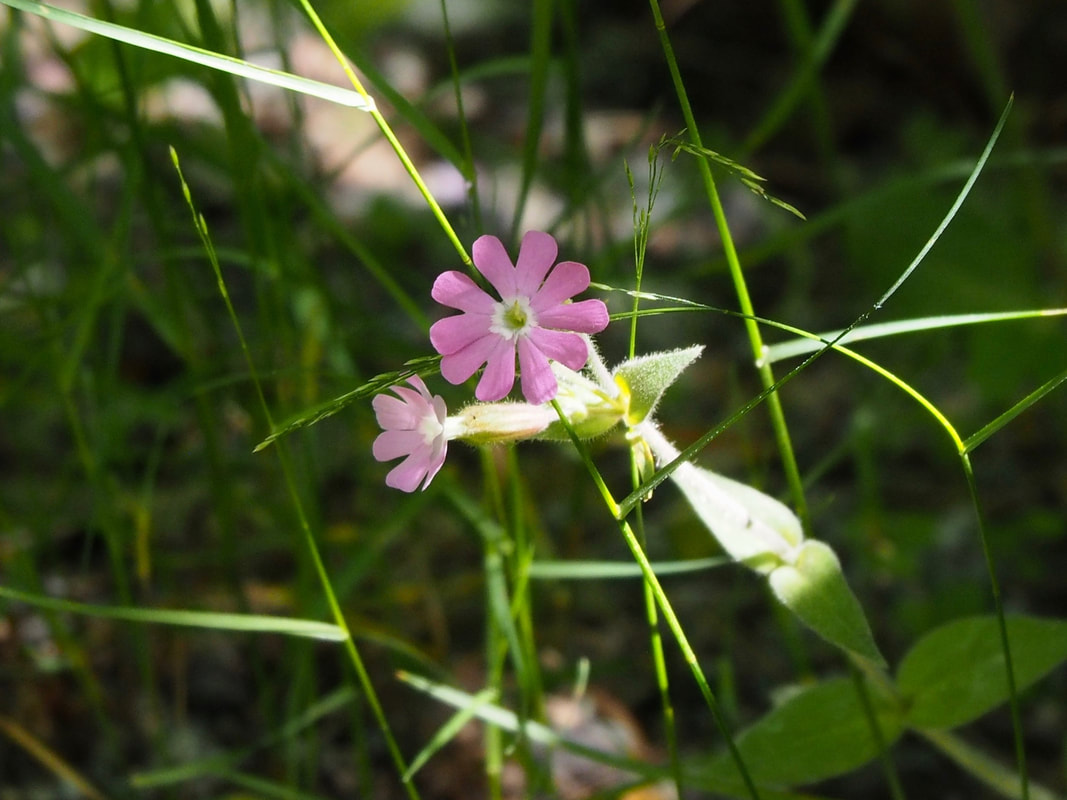
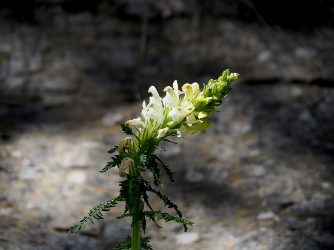
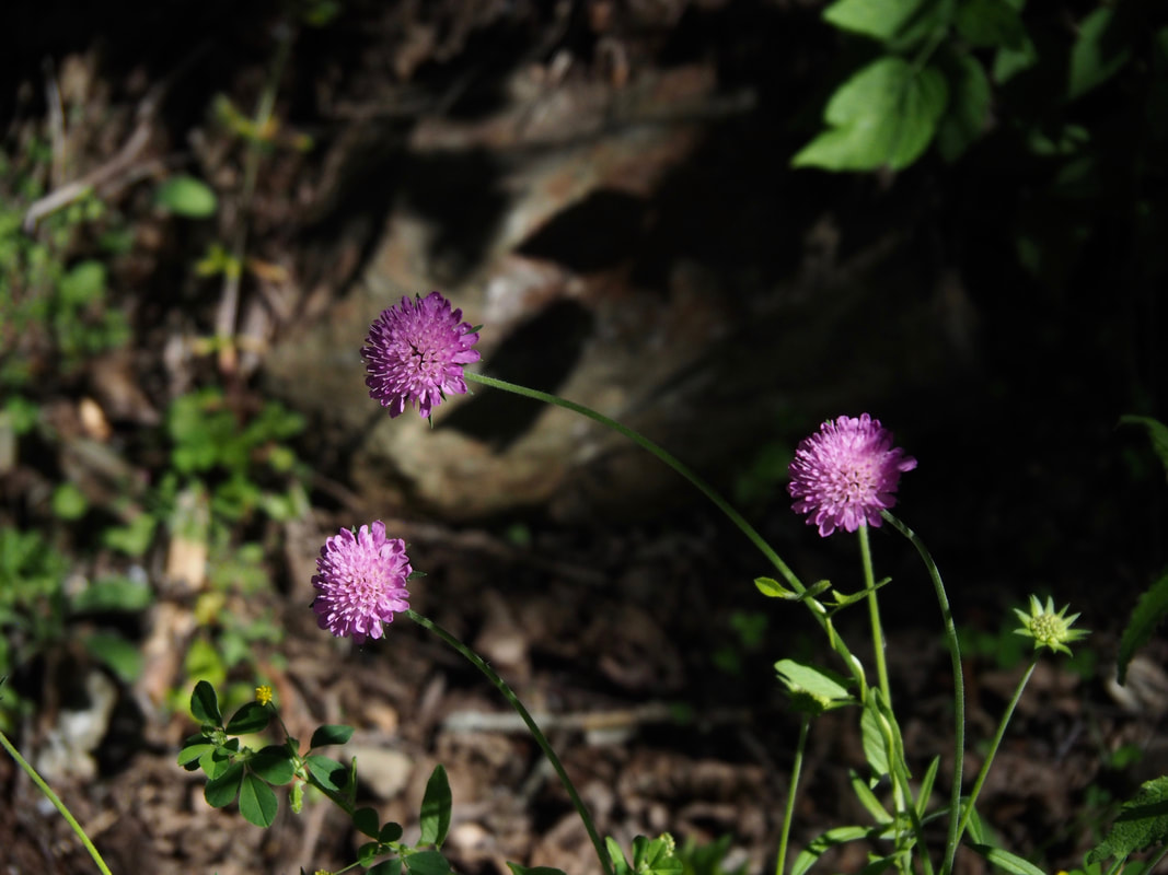
Although the valley seemed quite sheltered, clearly the flowers were as late here as on the plateau. Pink-red azaleas, clinging to crevices in the rock, were only just coming out. At ground level some plants looked tantalisingly close to blooming, but I only know the most common by their leaves alone, so had no idea what most were. Of those that were flowering, blue aquilegia studded shady areas of dense vegetation by the river. And another water-loving plant was prolific, with big heads of fuzzy pink. I felt I should know what this was and, after consulting my dad's alpine flower book, decided it might be Pyrenean valerian. I really could have done with Robin for this, but he and Martine were across the other side of the plateau, exploring the lakes around Mt Carlit.
Click photos to enlarge image.


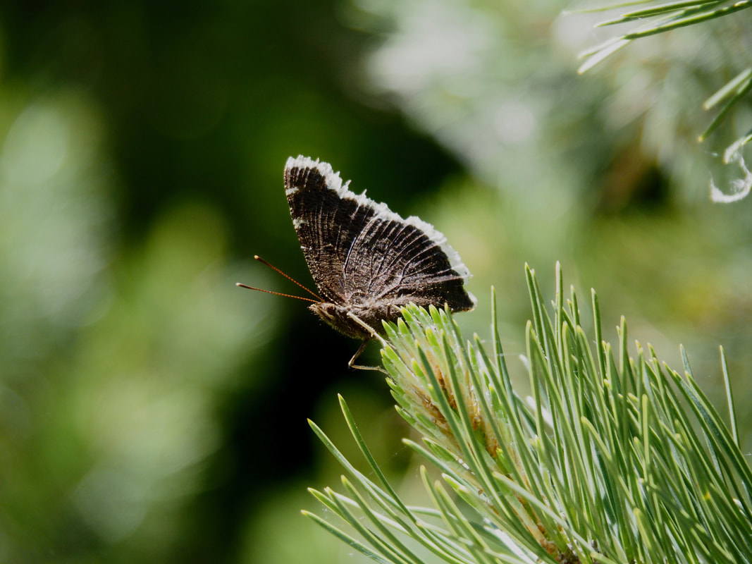
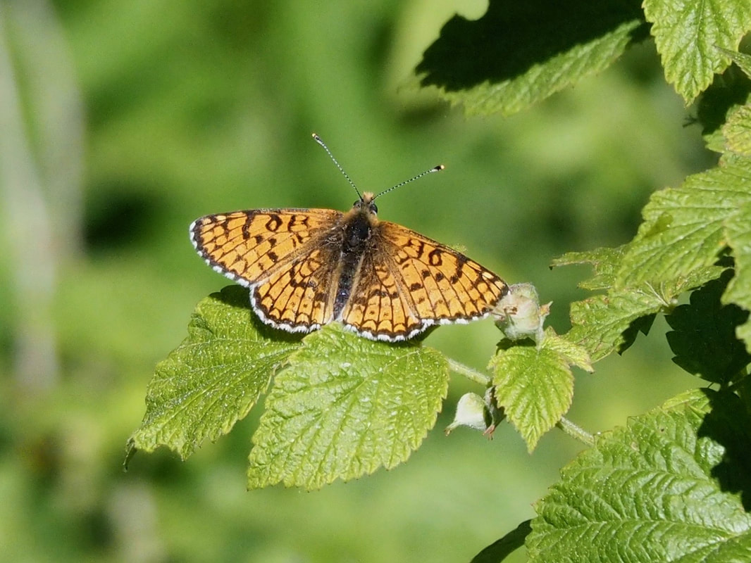
Alas, scant flowers meant scant butterflies. I shouldn't have been surprised after Bruce's experience. But as the temperature slowly rose, more did appear. This was was the third week of June, yet orange-tips (which fly in spring) were still abundant. Lots of whites, including green-veined. There were numerous fritillaries but all the same species - Glanville, I think - and several Camberwell beauties. (I last saw one of these years ago, in the Albères.) They proved frustrating. First impressions are of something big and very dark except for white edging on the wings. That day, this was my last impression too, because they refused to settle wings-open and reveal the inner line of purple spots, which earn them "beauty" in their name.
Click photos to enlarge image.
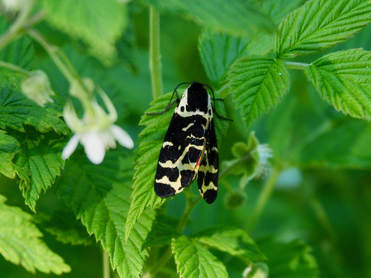
Wood tiger moth, sleeping on a plant beside the lane
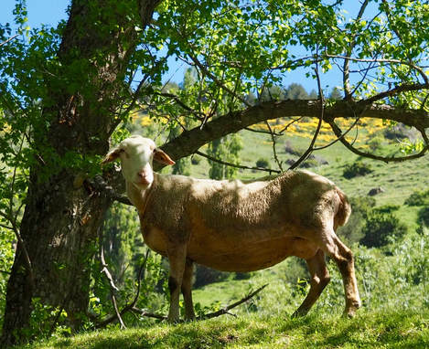
Early on, from the other side of a fence, this chap was keeping an eye on Digby.
The only birds I could hear over the noise of the river were robins, but I never saw them. Once, I glimpsed a grey wagtail flying along the river. No dippers. The crags constantly drew my eyes upwards in search of peregrines, vultures and eagles. All I spotted were crag martins. Perspective fooled me from time to time. A distant, perched raptor - at least buzzard-sized - raised my heart rate, until I got the binoculars on it and discovered it was a kestrel! One lone griffon vulture flew high overhead. This was most unexpected. Where was everything?
After about an hour of slow, mindful walking, with many stops for photos, the tarmac ended at a crossroads. I had a choice. To my left, a track led up and back towards Llo (the second half of the circular walk), which I guessed would be the most popular route. To my right, another, less obvious, track led quite steeply up as well. Straight on, a gentler-looking wide, stony path continued up the valley - as far as the Coll de Finestrelles on the Spanish border, according to the map. Unlikely I'd get quite that far (2064m), because I wasn't too keen on any steep uphill work, but I might make halfway or more. The map also promised open views across the hills to the left of the river. More chance of seeing those elusive eagles and vultures? That was the route for me. First though, time for a sit down in the shade of a tree. Water for the dog, water for me and ... how about one of those mini Kit Kats?
Depending on which order one has put on one's binocular harness, camera and rucksack, it can be quite a performance getting to one's Kit Kats. And it was only once Digby was tied to a tree and my equipment lay scattered around my feet that I discovered I had plenty of water and dog biscuits, but my sandwiches and vital chocolate rations were languishing on the kitchen worktop back at the chalet.
Plan B?
Cursing my stupidity, I decided to head towards the coll nevertheless. But as that direction would continue steadily uphill, I'd be foolish to go too far without food other than dog biscuits.
Watered and loaded with clobber once more, we set off. Although still following the river, we were soon much higher above it. The trees changed from deciduous to pine, but - as per the map - they began to thin out on our left. And there was no one here but us. Glorious.
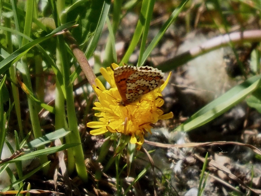
For a moment I nearly inhaled white butterflies. Green-veined again, but other species too - I'm not sure which - were congregating around a wet patch of mud. Every time a white flew past me I was hoping it might be an Apollo, but I think they were late or the habitat wasn't right. There were blues as well by now - and the occasional scarce swallowtail.
But the scenery stole the show. This stretch turned into one of those walks where you just have to see what's round the next bend. Every few metres the view seemed to improve yet again, leading me on and up. We stopped for another water break, looking down at a little wooden bridge over the river. Strangely, there was no visible track leading to or from it on either bank.
After about an hour of slow, mindful walking, with many stops for photos, the tarmac ended at a crossroads. I had a choice. To my left, a track led up and back towards Llo (the second half of the circular walk), which I guessed would be the most popular route. To my right, another, less obvious, track led quite steeply up as well. Straight on, a gentler-looking wide, stony path continued up the valley - as far as the Coll de Finestrelles on the Spanish border, according to the map. Unlikely I'd get quite that far (2064m), because I wasn't too keen on any steep uphill work, but I might make halfway or more. The map also promised open views across the hills to the left of the river. More chance of seeing those elusive eagles and vultures? That was the route for me. First though, time for a sit down in the shade of a tree. Water for the dog, water for me and ... how about one of those mini Kit Kats?
Depending on which order one has put on one's binocular harness, camera and rucksack, it can be quite a performance getting to one's Kit Kats. And it was only once Digby was tied to a tree and my equipment lay scattered around my feet that I discovered I had plenty of water and dog biscuits, but my sandwiches and vital chocolate rations were languishing on the kitchen worktop back at the chalet.
Plan B?
Cursing my stupidity, I decided to head towards the coll nevertheless. But as that direction would continue steadily uphill, I'd be foolish to go too far without food other than dog biscuits.
Watered and loaded with clobber once more, we set off. Although still following the river, we were soon much higher above it. The trees changed from deciduous to pine, but - as per the map - they began to thin out on our left. And there was no one here but us. Glorious.
For a moment I nearly inhaled white butterflies. Green-veined again, but other species too - I'm not sure which - were congregating around a wet patch of mud. Every time a white flew past me I was hoping it might be an Apollo, but I think they were late or the habitat wasn't right. There were blues as well by now - and the occasional scarce swallowtail.
But the scenery stole the show. This stretch turned into one of those walks where you just have to see what's round the next bend. Every few metres the view seemed to improve yet again, leading me on and up. We stopped for another water break, looking down at a little wooden bridge over the river. Strangely, there was no visible track leading to or from it on either bank.
Further on, a man who had overtaken us much earlier on the road now passed us again, from the opposite direction. So far, he was the only other person we'd come across on this section. I wondered how far he'd got and whether the track ahead became more difficult. Would I need my stick at some point? Thinking of which, where was my stick?
I thought I'd tied it onto my rucksack, but must have left it at the last water stop. What was the matter with me today? Altitude ditziness? I have other sticks, but that was an expensive Manfrotto. I wasn't about to go back for it, though, so ground my teeth and carried on, hoping the man would do the decent thing and leave it where it was.
We'd probably been going for another hour or so when I decided to head back. The track was getting steeper and, although the return trip would be all downhill, I would soon need food. With great reluctance, therefore, after scanning a distant peak for the last time (no raptors) and promising to return one day, I turned round.
Soon I started to encounter more walkers, and decided the chances of my stick not being picked up were now slim-to-remote. A couple of women hove into view. As we crossed paths and I narrowed my eyes at the poles they carried, one of them asked if I'd lost mine. Why yes, I replied. "La voilà," she said with a warm smile, pointing behind her. And there it was, a few metres ahead of me, resting against a bush, where I couldn't miss it.
With my faith in human nature restored, I fair bounded down the track after that - often in a kind of mad zigzag, trying to catch up with another Camberwell beauty.
At the crossroads, on regaining the asphalt road, I once again met the students hunting insects. Several of them were sitting down, scribbling notes and peering intensely into specimen jars. I hoped the scarce swallowtail I'd just spied wouldn't end up in one of those. I really wanted to quiz them on their mission, but failed to catch the eye of any, and when my jovial bonjours were studiously ignored, I walked on, none the wiser.
Back at the chalet I stoked up on calories, feeling high from the scenery, but disappointed that my day had been cut short. However, my ditzy moment proved to be a blessing. After studying the map again, I drove a pretty but at times hair-raising route forestière along the next valley south of Llo, and ended up at 2,000m by the ski station of Err-Puigmal. As soon as I stepped out of the car and looked around at this wild place, I had my plan for the next day.
*I've since read that construction of the centrale solaire thermodynamique (roughly 153,000sqm of mirrors) began in 2016. Dubbed "eLLO", it's scheduled to begin converting sunlight into into electricity for the EDF from this year. More info here.